
Cassettes and Compact Disks Gifts Visitor Guides & Maps Publications Tshirts 
|


Visitor Guides & Maps
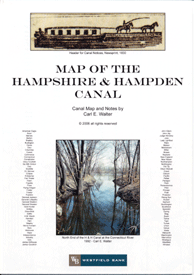 Map of the Hampshire & Hampden CanalThe Hampshire and Hampden Canal (1829 - 1847) Canal Map and Notes by Carl E. Walter Between 1835 and 1847 a canal connected New Haven, Connecticut and Northampton, Massachusetts, much as Interstate Highway 91 does today. Carl E. Walter's colorful topographic map includes notes and illustrations documenting the history of this vital link for transportation and commerce. $10 - currently out of stock |
Contents Historic Northampton.